| Map 067 |
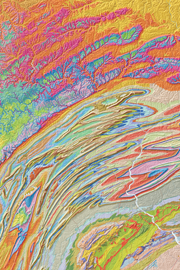
 | Geologic shaded-relief map of PennsylvaniabyMiles, C. E.2003 |
| Suggested Citation: | Miles, C. E., compiler, 2003, Geologic shaded-relief map of Pennsylvania: Pennsylvania Geological Survey, 4th ser., Map 67, scale 1:500,000. [Available online.] |
| Description: | This 1:500,000-scale, geologic shaded-relief map of Pennsylvania was prepared from the 1999 National Elevation Dataset for Pennsylvania—a product of the U.S. Geological Survey that provides regional elevation data for points spaced about every 30 meters—and the Pennsylvania Geological Survey’s 2001 dataset for bedrock geology. The elevation data were used to generate the shaded-relief image, which gives the map its three-dimensional appearance. The colors of the geologic units were made transparent and laid on top of the shaded relief. On the scanned image of the map poster, organization contact information was updated and printing credits were removed. A tabloid version (1:1,350,000-scale) of the poster was prepared in 2008 and is included in the download for this publication. |
| Download Publication: | Click Here (48 MB) |