| Map 066 |
 | Land-cover map of PennsylvaniabyU.S. Geological Survey2000 |
| Suggested Citation: | U.S. Geological Survey, compiler, 2000, Land-cover map of Pennsylvania: Pennsylvania Geological Survey, 4th ser., Map 66, scale 1:500,000. [Available online.] |
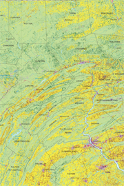
| Description: | This 1:500,000-scale, land cover map was prepared from the 1992 National Land Cover Data (NLCD) for Pennsylvania—a product of a cooperative project between the U.S. Geological Survey and the U.S. Environmental Protection Agency to produce a consistent land-cover data layer for the conterminous United States. The NLCD reflects Landsat Thematic Mapper (TM) imagery recorded primarily during the summer months of 1986 to 1993 and having a spatial resolution of 30 meters. Organization contact information that appears on the printed map poster was updated on the scanned image. A tabloid version (1:1,350,000-scale) prepared in 2008 is included in the download for this publication. |
| Download Publication: | Click Here (26 MB) |