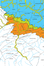
| Map 059 |
 | Glacial deposits of Pennsylvania (color)bySevon, W. D., and Braun, D. D.1997 |
| Suggested Citation: | Sevon, W. D., and Braun, D. D., 1997, Glacial deposits of Pennsylvania (2nd ed.): Pennsylvania Geological Survey, 4th ser., Map 59, scale 1:2,000,000. [Available online.] |
| Description: | A page-size map of Pennsylvania showing the general extent of the Wisconsinan, late Illinoian, and pre-Illinoian glacial deposits, and the presumed limit of glacial advance for each of those glaciations. In the northwestern part of the state, the mapped tills include the Wisconsinan Ashtabula, Hiram, Lavery, and Kent, the late Illinoian Titusville, and the pre-Illinoian Mapledale. In the northeastern part of the state are the Wisconsinan Olean Till and unnamed tills of late Illinoian and pre-Illinoian age. Stratified drift deposits are indicated along stream and river valleys, and along the Lake Erie shoreline. |
| Download Publication: | Click Here (1 MB) |