| Water Resource Report 64 |
 | Groundwater resources in and near the anthracite basins of Schuylkill and adjacent counties, PennsylvaniabyBecher, A. E.1991 |
| Suggested Citation: | Becher, A. E., 1991, Groundwater resources in and near the anthracite basins of Schuylkill and adjacent counties, Pennsylvania: Pennsylvania Geological Survey, 4th ser., Water Resource Report 64, 59 p. [Available online.] |
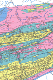
| Description: | In this report, the author describes the occurrence, availability, and quality of groundwater in and near the anthracite basins of east-central Pennsylvania. In particular, he reports his findings on the possibility of aquifer contamination by acid mine drainage. Major text topics include geologic and hydrologic properties of the rocks, hydrologic system, water-yielding properties of the rock units, and quality of groundwater. Tables of data, including water budgets, summaries of well statistics and water measurements, various chemical analyses, and a record of selected wells, support the text discussion. There is a 1:100,000-scale bedrock geologic map showing the locations of wells. Bedrock in the area includes Mississippian Pocono and Mauch Chunk Formations, Pennsylvanian Pottsville and Llewellyn Formations, and Jurassic diabase dikes. These units are described along with their water-bearing properties and water quality in the map explanation. |
| Download Publication: | Click Here (14 MB) |