| Water Resource Report 58 |
 | Groundwater resources of the Upper Susquehanna River basin, PennsylvaniabyTaylor, L. E.1984 |
| Suggested Citation: | Taylor, L. E., 1984, Groundwater resources of the Upper Susquehanna River basin, Pennsylvania: Pennsylvania Geological Survey, 4th ser., Water Resource Report 58, 136 p. [Available online.] |
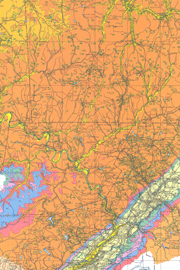
| Description: | A groundwater study of the Upper Susquehanna River basin, an area of approximately 4,200 square miles in northeastern Pennsylvania, is the subject of this report. The study area is one of abundant water resources, a result of high precipitation. The northern two thirds of the area is in the Appalachian Plateaus province, and the southern third is in the Ridge and Valley. Much of the plateau area has thick deposits of glacial till, and many stream valleys have thick outwash deposits. The underlying bedrock is sedimentary and ranges in age from Silurian to Pennsylvanian. Major text topics are hydrology, hydrogeology, groundwater quality, stratigraphy and water-bearing properties of the rocks, and management of water supplies. Tables include data on water use, summaries of well statistics and water measurements, records of wells and springs, and chemical analyses of groundwater. There is a plate with a 1:250,000-scale geologic map, showing the locations of wells, springs, and significant alluvium deposits. The map explanation describes each geologic unit and its associated well yields and water quality. Also on the plate is a small-scale map illustrating the median hardness of groundwater. |
| Download Publication: | Click Here (17 MB) |