| Water Resource Report 53 |
 | Groundwater resources in the Cumberland and contiguous valleys of Franklin County, PennsylvaniabyBecher, A. E., and Taylor, L. E.1982 |
| Suggested Citation: | Becher, A. E., and Taylor, L. E., 1982, Groundwater resources in the Cumberland and contiguous valleys of Franklin County, Pennsylvania: Pennsylvania Geological Survey, 4th ser., Water Resource Report 53, 67 p. [Available online.] |
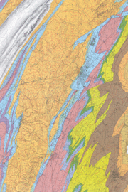
| Description: | This is an appraisal report of the groundwater resources of shale and carbonate rock (Cambrian and Ordovician) in the southern part of the Cumberland Valley and in several smaller contiguous valleys to the west where they occur in Franklin County. The report describes the geologic setting and hydrologic system, evaluates the yield potential of the rocks, discusses the criteria important to well-site selection, and describes the quality of the groundwater and problems associated with local availability, contamination, and flooding. Data are presented in 14 tables, including summary tables of well statistics and water measurements, records of wells and springs, and chemical analyses of groundwater. There is a 1:50,000-scale hydrogeologic map of the county, showing the locations of wells and springs. In addition to the geologic units, map data includes contours of the average elevation of the groundwater surface, fracture traces, strikes of cave passages, and faults. The map explanation describes each geologic unit and its aquifer characteristics. |
| Download Publication: | Click Here (37 MB) |