| Water Resource Report 15 |
 | Geology and hydrology of the Neshannock quadrangle, Mercer and Lawrence Counties, PennsylvaniabyCarswell, L. D., and Bennett, G. D.1963 |
| Suggested Citation: | Carswell, L. D., and Bennett, G. D., 1963, Geology and hydrology of the Neshannock quadrangle, Mercer and Lawrence Counties, Pennsylvania: Pennsylvania Geological Survey, 4th ser., Water Resource Report 15, 90 p. [Available online.] |
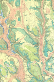
| Description: | This is a detailed report on the geology and groundwater resources of the Neshannock 15-minute quadrangle in western Pennsylvania, which includes three plates. Plate 1 has a 1:24,000-scale, full-color geologic map showing areas underlain by Mississippian- and Pennsylvanian-age bedrock units, areas of glacial deposits where those deposits are at least 25 feet thick, and the location of water wells. Errors in the printed colors of the geologic units in two areas were corrected on the map image. The other two plates show cross sections from the map area. Major text topics include an introduction, geography, geology, and groundwater. The geology section describes stratigraphy, subsurface and surface bedrock units, unconsolidated deposits, structure, and mineral products and fuels. The groundwater section includes general features, hydraulic properties of the rocks, the groundwater system, well performance, and water quality. Three tables list (1) mineral products (except oil and gas) of the quadrangle during 1959, (2) records of representative wells, and (3) chemical analyses of groundwater. |
| Download Publication: | Click Here (49 MB) |