| Water Resource Report 05 |
 | Ground water in south-central PennsylvaniabyLohman, S. W.1938 |
| Suggested Citation: | Lohman, S. W., 1938, Ground water in south-central Pennsylvania: Pennsylvania Geological Survey, 4th ser., Water Resource Report 5, 315 p. [Available online.] |
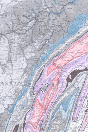
| Description: | This comprehensive report describes the geography, geology, and groundwater conditions in a 9,769-square-mile area that includes Bedford, Blair, Cambria, Centre, Clearfield, Clinton, Fulton, Huntingdon, Juniata, Mifflin, Perry, Snyder, Somerset, and Union Counties in the south-central part of the state. After an area-wide review, the report focuses on the topics by county. Information was gathered from 1,173 wells and springs that furnish municipal, industrial, and domestic supplies, and from well owners and drillers. In order to determine the chemical character of water, samples of water were collected from 92 representative wells and springs from across the area, and (for comparison) 5 samples were collected from surface streams. Water well and spring characteristics and results of the chemical analyses are tabulated by county and given in the section of county descriptions. The report includes two maps at approximately 1:360,000 scale: one a geologic map and cross section, and the other a map showing the locations of inventoried wells and springs. |
| Download Publication: | Click Here (51 MB) |